Well Data
Interactive Well Site
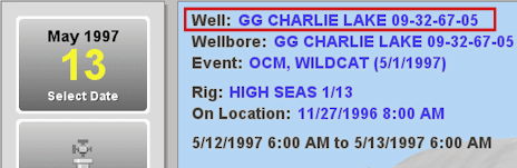
The current Well's properties are defined in the Well Properties dialog. This dialog is accessed by clicking on the blue Well hyper link, located in the upper right corner of the well site canvas.
The Well Properties dialog allows users allows users to add, review, modify and delete Well data. The information fount in this dialog is ready-only to users without the appropriate permissions to edit a well.
For information on creating a new Well from the interactive well site, see the Create Well topic.
The Well Properties dialog is organized into the following sections. Click a topic to view more information.
General - Record general information used to identify the well, such as the name, purpose and spud date. The Well can also be locked from this area.
Depth Reference - Define Reference Datum Level elevations relative to the System Datum for the Well. These datums identify the reference depth for which all depth information is entered. This area also identifies the Well as onshore of offshore.
Location - Define the Wellhead center location and Well position error relative to the Project Geodetic configuration.
Status - Record changes over the life cycle of the Well and record the changing state of MAASP values over the life cycle of a Well.
Remarks - Capture time context-sensitive information about the Well.
Associated Partners - Maintain a list of partner contacts from other Companies with a commercial interest in the Well.
Alias - Document alternate names for the Well, such as, old Well names. This area is also used to associate EDM™ database Wells to equivalent Wells present in other software systems.
Location Description - Define Unique Well Identifiers (UWI) using a variety of pre-defined formats.
Audit - Tracks modifications to data.
AutoSync - add and remove a Well from AutoSync Client control in order to synchronize data between the Rig and Regional Office.